Wildfire Modeling
Updated Feb 2026
PythonJavaScriptREarth Enginescikit-learn
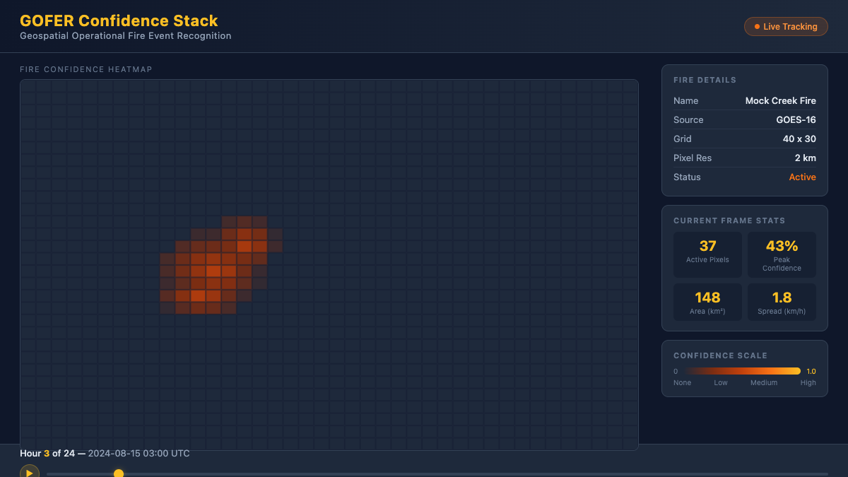
Wildfire Modeling is a research workflow for collecting wildfire-related geospatial data, converting it into GOFER-style JSON, and running local regression analyses over fire spread and continuation. It sits between raw remote-sensing data and downstream modeling experiments.
Earth Engine download and normalization pipeline
Locational spread + continuation regression workflows
Lightweight local viewer for GOFER-style JSON outputs
What I built
- CLI scripts for downloading GOES confidence stacks and aligned RTMA meteorology
- Conversion tools that normalize geospatial outputs into modeling-friendly JSON
- Regression workflows and notebooks for single-fire and multi-fire analysis
How it works
- 1Download wildfire confidence stacks and aligned meteorology
- 2Convert outputs into GOFER-style JSON time series
- 3Run locational regressions and inspect outputs through notebooks or the local viewer
Results
- ✓Repeatable research workflow from Earth Engine exports to regression outputs
- ✓Supports both single-fire analysis and broader multi-fire experiments
Next steps
- Tighten environment bootstrapping and add clearer example outputs
- Expand the multiresolution data path and result visualization